Application of GIS in the environment
When we talk about Geographic Information Systems (GIS), many sectors come to mind in which this technology plays a very relevant role: logistics and distribution, urban planning, sustainable mobility, promotion of local commerce, etc. But what is the application of GIS in the environment? In which areas can they play a vital role? And most importantly, what concrete actions can they enable?
What is the current state of the environment?
The current environmental situation has long been of concern to citizens, businesses and public administrations, and the figures are alarming:
- Worldwide emissions of gases have reached a new record high this year, with 40.6 billion tonnes of CO2.
- In places like China, the United States and India, coal is the source of most emissions in recent years, with 11.4 billion tonnes, 5.1 billion tonnes and 2.9 billion tonnes respectively.
- And what about the concentration of CO2 in the atmosphere, with a monthly average of 415.51 ppm at the Izaña Observatory (Tenerife) in December 2020.
- Because it is not only CO2, but also the increase in the concentration of other gases such as methane, by 13%, and nitrous oxide, by 9%, over the last ten years.
And these data are just one example of global climate change and pollution, but drought is also a warning sign:
- In Spain, the hydrological year from 2021 to 2022 has been the third driest since records have been kept in the last 61 years.
- Accumulated rainfall on the peninsula from 1 October 2021 to 30 September 2022 was 25% lower than previous normal records.
- Likewise, according to the latest available data provided by the Ministry of Ecological Transition, at the end of August, 38.5% of Spanish territory was in prolonged drought, double the figure for the same date last year, at 19.3%, with the basins of the Guadiana, Tagus, Ebro, Duero, MIño-Sil and Galicia Costa being the most affected.
How to protect the environment using technology?
Fortunately, and despite the alarming data, there is still time, and it is precisely the technology created and developed by mankind that can be the ally that the planet and our survival on it need.
But when we talk about protecting the environment using technology, what do we mean? To concrete facts, such as digital transformation. Think of the many companies that are reducing their paper consumption through cloud storage and in-memory systems, which is making a huge contribution to reducing deforestation.
We are also talking about home automation, which has promoted the concept of smart homes and buildings, because not only the home can be smart, but also the workplace, considerably reducing energy consumption through thermostats and lights that are automatically regulated when necessary.
Sustainable mobility is also related to the environment, thanks to electric cars, which help to reduce pollution, and renewable energies, which are becoming increasingly attractive and accessible.

Geotechnologies to protect the environment
But let’s go a step further, going deeper into the geotechnologies that make environmental management and protection possible.
When we talk about geotechnologies, we refer to all those engineering tools and software that facilitate the collection, storage, processing and analysis of geographic information.
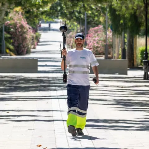
What devices or solutions are associated with this concept? The list is extensive: from GPS, laser scanners, thermal cameras, drones, georadars and LiDAR, sensors, etc. to software that favours the integration and study of this data, such as Geographic Information Systems.
Thus, thanks to the work, firstly, of collecting and compiling, as well as the subsequent analysis of the data, the information can be visualised in different media and formats, which favours not only the sending of this data to third parties, such as clients, but also the effective taking of decisions. Because what is the point of using technology to protect the planet if, in practice, instead of saving resources, we end up wasting them?
Inventory of GIS data applied to municipal green areas and gardens
Fortunately, another of the most cutting-edge tools in the management and maintenance, not only of the environment, but in a more specific and concrete field, of green areas and municipal gardens, are the intelligent urban inventories and SaaS for the management of urban services, both developed by Fisotec.
Thanks to them, using GIS technology, it is possible to evaluate, measure, manage data and draw up cartographies to make an accurate diagnosis, without effort or cost overruns, in the case of public green spaces in poor condition due to bad weather, wear and tear or human action.
In this way, public waterways, forests, urban parks and municipal gardens can be correctly managed through a detailed analysis, leading to numerous advantages, such as continuous operational maintenance, optimisation of resources and the evolution of the environmental system.